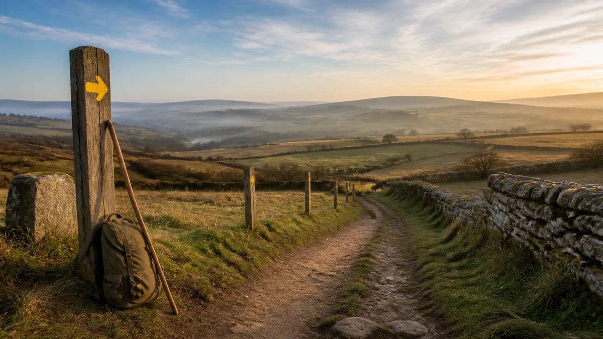
The Camino Francés begins in the French Pyrenees and reaches Santiago de Compostela roughly 780 kilometers later, a walk of about a month that pilgrims have made along one version of this road or another since at least the ninth century.
How long is the Camino Francés, and where does it start?
The route runs about 780 kilometers (485 miles) from the town of Saint-Jean-Pied-de-Port, just over the French border, across the Pyrenees and into northern Spain, ending at the cathedral in Santiago de Compostela. Most pilgrims who walk the full route take around 30 days to finish it.
Not everyone starts at the French border. A common shorter option begins in Sarria, a Galician town that sits just past the minimum distance required for the completion certificate, and takes most walkers five to seven days to finish. Along the way, the route passes through what has been described as green farmland and market towns, with an infrastructure of pilgrim accommodation that has grown up around the path over centuries.
How old is this pilgrimage, and why is the route protected as heritage?
People have walked toward Santiago de Compostela for more than a thousand years, a tradition that UNESCO traces to the ninth-century discovery of a tomb believed to belong to the apostle James the Greater. The Routes of Santiago de Compostela, including the Camino Francés and a set of routes across northern Spain, were inscribed as a UNESCO World Heritage site in 1993 and the listing was extended in 2015.
UNESCO's citation for the site credits it with a role that outlasted its original religious purpose: the routes "played a crucial role in the two-way exchange of cultural advances between the Iberian Peninsula and the rest of Europe, especially during the Middle Ages," functioning as a commercial corridor and a channel for the spread of ideas as much as a devotional path. The designation also points to the density of surviving architecture along the way, ecclesiastical and secular structures spanning the Romanesque through Baroque periods, as evidence of the route's long, continuous use.
How is the route marked along the way?
Walkers on the Camino Francés follow a yellow arrow, a waymarking system that is younger than the pilgrimage itself. According to the regional pilgrimage authority responsible for the route in Galicia, the arrow was conceived in 1984 by the priest Elías Valiña of O Cebreiro, who took on the task of signposting the route with yellow arrows from France to Compostela. Today those markers appear as yellow paint on a blue background, on vertical signal panels that identify the path as a European Cultural Itinerary.
Alongside the arrow, pilgrims also encounter the scallop shell, an older and more historical emblem of the route, carved into churches and monuments along the way long before the modern signage existed. Both symbols now function together as the visual shorthand of the Camino, guiding walkers turn by turn through towns and open countryside alike.
What kind of terrain and company should a pilgrim expect?
The Camino Francés is also the most heavily used of the Camino routes. It crosses the Pyrenees near its start and continues through what travel coverage comparing the Camino routes has characterized as rolling vineyard country and comparatively easy terrain, passing through busier towns than the quieter coastal and northern alternatives. That popularity brings trade-offs: dense company on the trail and in albergues during peak season, weighed against an unmatched depth of pilgrim infrastructure built up specifically to serve people walking this exact path.
What does a pilgrim need to do to earn the Compostela?
The Compostela is the historic Latin-language certificate awarded to pilgrims who complete the route for religious or spiritual reasons, issued by the Pilgrim's Reception Office attached to the Cathedral of Santiago. To qualify, a pilgrim must cover at least the final 100 continuous kilometers on foot or horseback, or the final 200 kilometers by bicycle, with the last stage ending at the cathedral itself. Pilgrims who begin their journey outside Spain need only complete the final 70 kilometers once they cross into the country.
Proof of that distance comes from the credencial, the pilgrim passport that must be stamped along the way, at the start and end of each stage, with the corresponding date. The Xunta de Galicia's own guidance for the route specifies that the credencial should be stamped at least twice a day over that final stretch, and notes that the only credencial recognized as valid is the one issued through the Pilgrim's Office itself. The Compostela does not require walking the distance in one unbroken stretch; it can be completed across separate trips, as long as the stamps and dates line up.
What should a pilgrim carry, plan, and expect before setting out?
Beyond the physical walk, the practical groundwork is mostly documentary: obtaining a credencial in advance, since blank passports can be difficult to find once on the trail, and understanding that the stamped document is what gives access to both the albergue network and, eventually, the certificate in Santiago. The albergues themselves are described as inexpensive, hostel-style lodging created specifically for people walking the route, distinct from ordinary tourist accommodation. For a pilgrim planning a first Camino Francés, the shape of the decision is less about equipment than about which stretch of the road, and how much of its thousand-year history, they intend to walk.
For more context, read How to stay a week in one place.